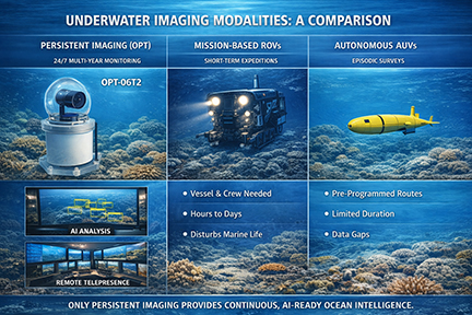
By delivering continuous, long‑duration, real‑time visibility into marine environments, OPT enables scientists, industrial organizations, and public aquariums to observe as it happens. This uninterrupted presence reveals patterns, behaviors, and ecosystem dynamics that short‑duration missions simply cannot capture.
With more than two decades of deployment‑proven systems, OPT has become the trusted leader in Persistent Underwater Imaging — empowering research, accelerating discovery, and creating a living, always‑on window into the ocean.
Now is our 25th year, OPT specializes in designing and manufacturing a comprehensive range of underwater IP video equipment, available in both high and standard definition. Our product line includes cameras, underwater lighting, remote power systems, data recorders, and wireless network components. Cameras have been used for Underwater Imaging, Ocean Conservation, Marine Biology, Environmental Monitoring, Underwater Research, Educational Outreach, Live Streaming, Remote Sensing, Underwater Surveillance and as Submersible Cameras on ROVs (Remotely Operated Vehicles).
Artificial Specialized Intelligence (ASI), as compared to AGI (Artificial Generalized Intelligence) is a new class of AI tools that is trained on highly focused data sets to perform narrowly specialized applications.
"AI underwater imaging applications seeks a different type of AI that is engineered to excel at one specific task or a tightly defined set of tasks. Artificial Specialized Intelligence (ASI) is trained on a narrowly focused sets of real world information within a well defined application of a branch of science such as marine biology or a single species such as manta rays. After creating a data model, it can help enhance work efficiency and thereby support the scientist in their research. It can uncover relationships that would otherwise be lost within the massive data files." From "The Future of Ocean Exploration - AI-Enhanced Underwater Cameras," Amazon Publishing, 2025)
Introducing OceanCam® OPT-06T2 - the first in a new series of Artificial Specialized Intelligence (ASI) cameras
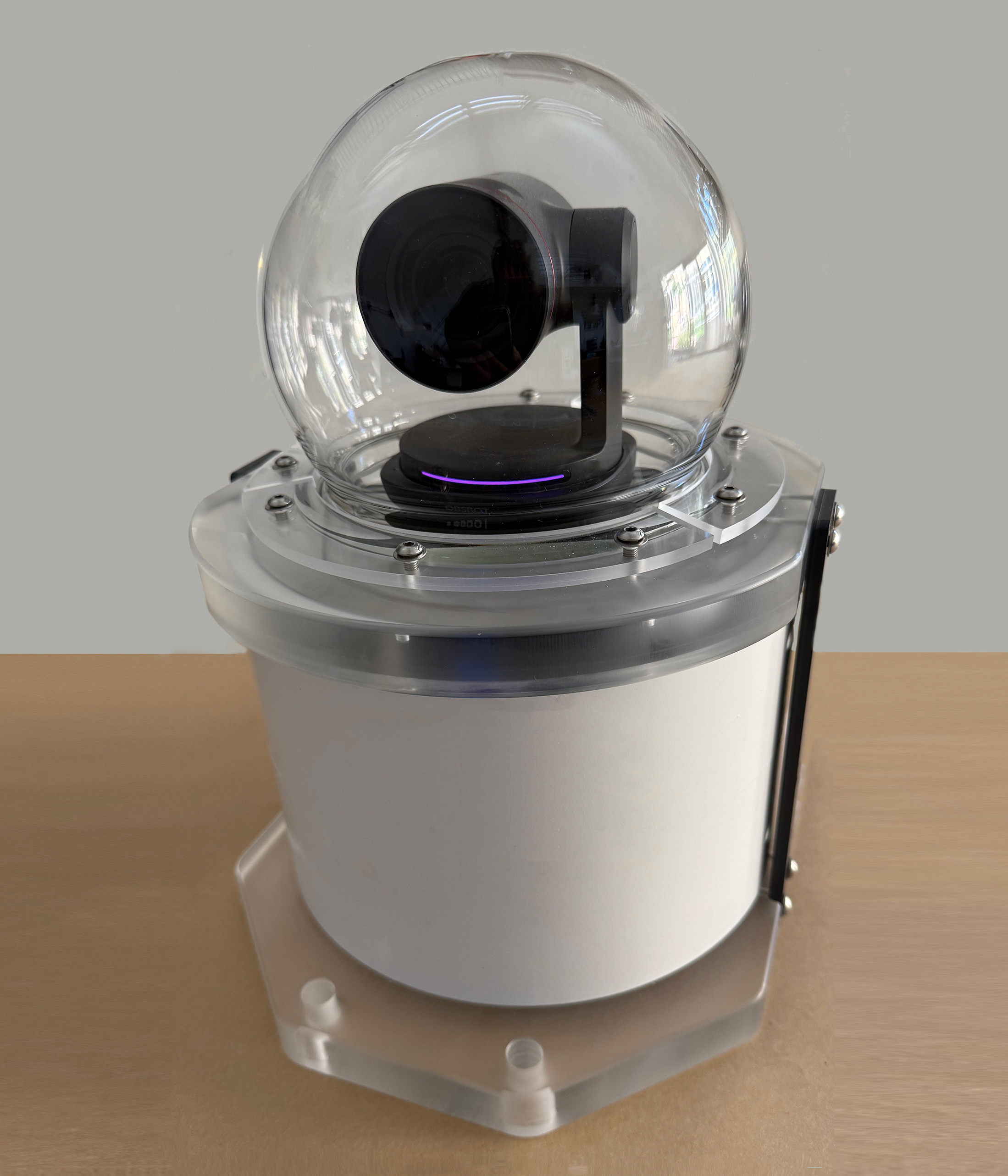
The OceanCam® OPT-06T2 is a broadcast-quality ASI camera featuring seamless pan-tilt-zoom control and advanced AI image tracking in a rugged, waterproof housing. It captures ultra-HD 12K, 50 MP 16:9 video for crystal-clear live-streaming, research, and conservation work, with up to five hours of battery-powered recording and expandability for extended untethered operation.
Experience the power of ultra-high-definition with 12K video, 4K/60p or high-speed 120 frame per second 1080p video. Capture fast-moving subjects with stunning clarity, reduced noise, and minimal motion blur.